
News Summary
Spartanburg, SC is facing significant weather changes this week with thunderstorms expected Tuesday, followed by a steep drop in temperatures overnight. Residents are warned about potential severe weather, including heavy rainfall and gusty winds. Although Wednesday will bring sunny skies and warmer temperatures, rain is anticipated again by Thursday. A local cold shelter will be open for those needing warmth during this chilly stretch. Stay updated on weather alerts and safety tips as the region experiences this spring cold snap.
Spring Weather Whiplash Hits Spartanburg, SC!
Spartanburg, South Carolina, is in for quite the weather rollercoaster this week as a spring cold snap looms in the forecast. Residents should brace themselves for a day of thunderstorms and strong winds on Tuesday, followed by a noticeable drop in temperatures as we head into the night.
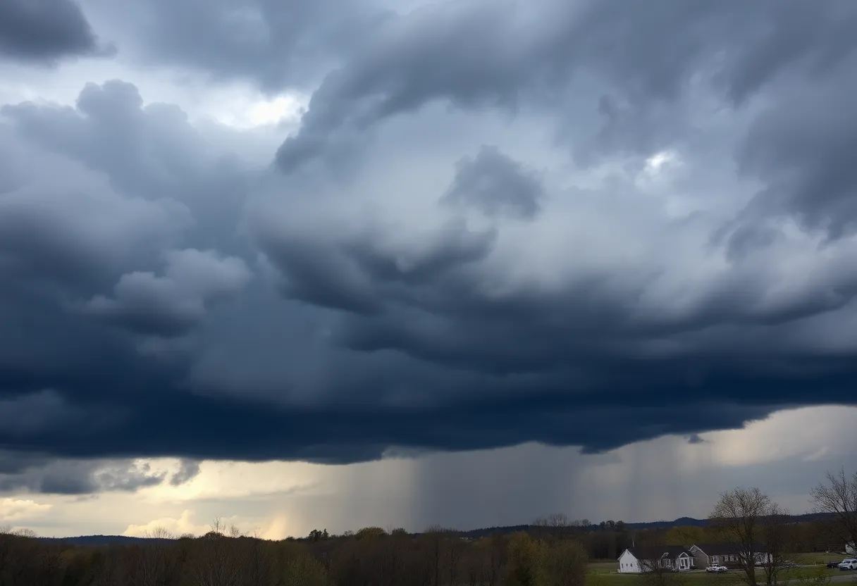
Thunderstorm Alert for Tuesday
The National Weather Service has their eyes on the skies over Spartanburg, Greenwood, York, and even the nearby Charlotte area, predicting scattered to numerous thunderstorms throughout Tuesday. With storm conditions expected to escalate, there’s potential for severe weather that could bring along heavy rainfall, gusty winds, and even the possibility of hail!
As if that wasn’t enough, commuters traveling on I-85 are being warned to take it easy and navigate with caution due to the expected severe weather conditions. Visibility may be hampered, and sudden gusts of wind could impact your drive.
Temperature Tumble Tonight
Fast forward to Tuesday night, and you can say goodbye to the storms, as skies are set to clear up. However, this doesn’t mean it’s time to put away your jackets just yet! Oh no, temperatures are predicted to dip quite low. In some parts, especially near the foothills of North Carolina and the northwest Piedmont, lows could plummet to about 36°F. That’s downright chilly! Residents with delicate plants should take extra care to shield them from the potential frost, which could crop up early Wednesday.
Wednesday’s Weather: A Welcome Change
Good news! Wednesday is expected to bring calm and sunny conditions, with daytime highs climbing to around 62°F. Light northeast winds should make for a pleasant day to get outside, assuming you have your warm clothes handy.
The Warm-Up Begins
As we peek towards Thursday, better days are on the horizon. Prepare for a warming trend as temperatures are projected to hit a comfortable 70°F. However, don’t put your umbrella away just yet! Rain chances will spike again by Thursday night, with about a 50% chance of showers expected. Friday looks to follow suit with similar chances of rain.
Five Day Outlook
The weekend promises to offer some optimistic changes, with a return to warmer and drier conditions by Sunday, where highs are estimated to reach into the upper 60s. A great time to enjoy the outdoors!
Severe Weather Warnings and Safety Tips
Remember, lightning strikes are no joke! They can happen around 25 million times a year in the U.S., although summer sees the most activity. Always stay indoors during thunderstorms and steer clear of electrical appliances to keep safe.
Back to Cool Weather
For those who were hoping for some warmer weather, they will have to wait just a bit longer. Tuesday and Wednesday will have cooler daytime highs in the lower 60s and nighttime lows around 40°F. And yes, parts of Spartanburg could be treated with a light dusting of snow on Wednesday morning, tapering off by sunset. How’s that for a mixed bag of spring weather?
A Local Cold Shelter Open!
Lastly, if you’re feeling the chill, Spartanburg County plans to open a cold weather shelter from 8 p.m. to 11 a.m. on both Wednesday and Thursday nights, possibly extending until Sunday morning. A nice option for anyone in need of a warm place during these brisk evenings!
So there you have it, Spartanburg! Keep an eye on the weather, and don’t forget to bundle up. Stay warm and safe out there!
Deeper Dive: News & Info About This Topic
HERE Resources
Severe Thunderstorm Warning Hits Anderson and Abbeville Counties
South Carolina Becomes the Fastest Growing State in 2024
Upstate South Carolina Schools Transition to eLearning Days
Severe Thunderstorm Warnings Impact Upstate South Carolina and Georgia
Severe Thunderstorms Rattle the Tri-State Area
Understanding Digital Marketing Costs: What Businesses Need to Know for 2025
Greenwood County Council Advances Rezoning Initiatives
Greenwood, SC Sees Surge in Violent Incidents, Multiple Arrests Made
Upcoming Events in Upstate South Carolina
Severe Thunderstorm Warning for Spartanburg and Greenwood Counties
Additional Resources
- Weather.com: 10-Day Forecast
- Island Packet: Weather News
- Greenville Online: Local News
- Charlotte Observer: Weather News
- Fox Carolina: Winter Weather Update
- Wikipedia: Weather in Spartanburg, SC
- Google Search: Spartanburg SC Weather
- Google Scholar: Spartanburg Weather
- Encyclopedia Britannica: Spartanburg
- Google News: Spartanburg Weather